Types of content
Geography here is not merely a backdrop — it is the organizing logic of the entire visit. Knowing how the park is structured spatially determines which towns you use as bases, which roads you travel, and how many days you actually need to see what you came for.
Where the park sits in Argentine Patagonia
Los Glaciares National Park, Argentina, occupies the southwestern corner of Santa Cruz Province, pressed against the Austral Andes along the Chilean border. Directly to the south, across that border, Torres del Paine National Park continues the same ice-and-granite drama — the two protected areas effectively forming one vast, binational wilderness meeting point.
El Calafate functions as the park's administrative hub, though the town itself sits just beyond the official boundary, on the southern shore of Lake Argentino. The northern reaches of the park are accessed through El Chaltén, a small mountain village built almost entirely around trekking culture. Quieter corners also exist — Lago Roca inside the park's southern sector, and Lago del Desierto just beyond its northern boundary in a provincial reserve — though these tend to attract travelers who have already done the headline sights and want something less frequented.
How the northern and southern sectors differ
Los Glaciares does not function as a single, continuous zone. The park divides cleanly into two separate sectors, each centered on its own major lake, with an intermediate stretch called Zona Centro occupying the land between them — an area that sees virtually no tourist traffic.
|
Feature
|
Northern Sector
|
Southern Sector
|
|
Main lake
|
Lake Viedma (1,100 km²)
|
Lake Argentino (1,466 km², largest in Argentina)
|
|
Gateway town
|
El Chaltén
|
El Calafate
|
|
Known for
|
Fitz Roy, Cerro Torre, granite trekking peaks
|
Perito Moreno, Upsala, Spegazzini glaciers
|
|
Vibe
|
Mountain trails and climbing culture
|
Ice calving at lake level
|
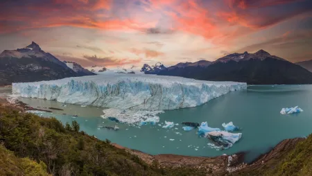
The southern sector draws its glaciers directly from the South Patagonian Ice Field, depositing them at near-lake level — an unusually accessible position for ice of this scale. Lake Argentino runs 160 kilometers end to end, which means the boat crossing to the glacier faces feels less like crossing a lake and considerably more like crossing an inland sea. Traveling between the two sectors covers roughly 220 kilometers of road and takes around three hours, so anyone planning to experience both halves should account for that transit time from the outset.
Why its glaciers and landscapes earned UNESCO status
UNESCO's 1981 inscription of Los Glaciares as a World Heritage Site rested on two distinct grounds: the landscape's outstanding natural beauty, and its scientific value as a living record of glacial processes still actively reshaping the earth. The second of these — Criterion viii — is particularly telling. The park functions, in effect, as an open-air archive of Pleistocene and Holocene glaciation, where moraine systems and lake basins are not relics but ongoing formations.
The numbers behind this designation are striking. The South Patagonian Ice Field — the source of the park's glaciers — holds the distinction of being the largest continental ice extension on the planet after Antarctica and Greenland. From this single ice mass flow 47 major glaciers, 13 draining toward the Atlantic, alongside around 200 smaller glaciers that operate independently of the main field. Approximately 30% of the entire park remains ice-covered. What makes this particularly remarkable is the altitude at which these glaciers exist: while most of the world's glaciers originate above 2,500 meters, these begin forming at just 1,500 meters and descend to 200 meters, bringing the ice within reach of visitors who would never otherwise encounter it at such proximity.
The park's ecological range adds further weight to its heritage status. An altitudinal span exceeding 3,000 meters accommodates Magellanic subantarctic forest, transitional woodland, and open Patagonian steppe — three distinct ecosystems coexisting within the same boundary. Puma, the endangered huemul deer, Andean condor, torrent duck, and Magellanic woodpecker all find habitat here. Visitor numbers reflect growing international recognition: the park set a record in 2023 with roughly 689,000 visitors, and it continues to receive more than 600,000 people a year.
![Lake Argentino El Calafate aerial view]()
Knowing that the park divides into two distinct sectors is one thing; deciding how to spend your time within each is another matter entirely. Los Glaciares National Park Argentina presents a remarkable range of encounters with its ice — some requiring nothing more than a steady pair of legs, others demanding crampons, dry suits, or a full day aboard a vessel crossing one of Argentina's largest lakes.
See Perito Moreno Glacier from the walkways
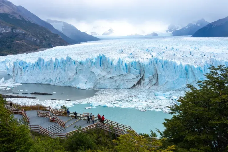
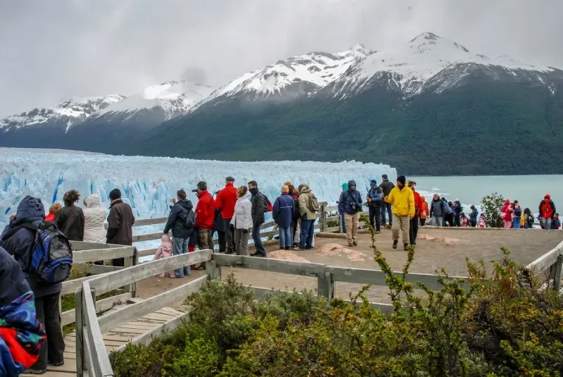
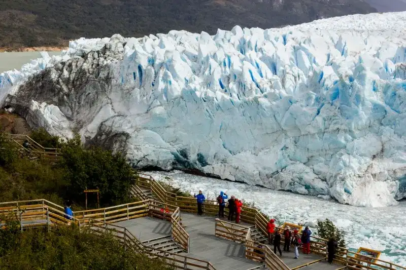
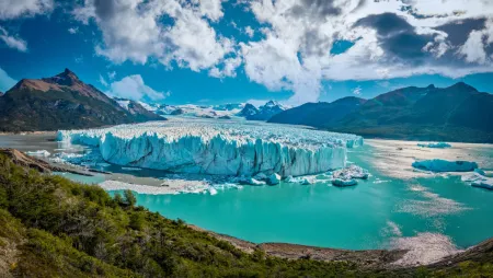
The walkway system at Perito Moreno sits 75 to 80 kilometers west of El Calafate and traces roughly 4 kilometers across five color-coded circuits. Each circuit targets a different vantage point along the glacier's face. The Yellow Circuit covers 600 meters and frames the classic frontal view that appears in virtually every photograph of the park. Those willing to descend stairs will find the Red Circuit — about 1,100 meters of path that drops to a lower, more immediate angle directly opposite the calving face. The Blue Circuit extends 1,117 meters along the lakeside for a broader perspective; the Green (Forest) Circuit covers 570 meters, and the Purple (Accessible) Circuit offers 564 meters of step-free access designed for travelers using wheelchairs or strollers. Private cars stay in the lower parking area, from where a shuttle takes visitors up to the walkways; the upper car park is reserved for visitors with reduced mobility. Covering the main circuits at a measured pace takes three to four hours.
Compare guided ice treks and kayaking tours
Stepping onto the glacier itself, or paddling toward its 60-meter face from lake level, represents an entirely different order of experience from the walkways. The principal options are laid out below:
|
Activity
|
Duration on ice/water
|
Minimum age
|
Starting price
|
|
Minitrekking
|
About 1.5 hours
|
8 years (max. 65)
|
From about USD 320
|
|
Big Ice Trekking
|
About 3 hours on ice plus a 1-hour moraine approach
|
18 years (max. 50)
|
From about USD 545
|
|
Kayak (Half Day)
|
1.5 hours paddling, about 4 hours total
|
14 years
|
From about USD 545 (with transfers and walkways)
|
Ice trekking demands full attention to crampon placement and the glacier's fractured surface topography, while kayaking reframes the glacier entirely — the focus shifts outward to the vast ice wall and the deep reflections it casts across Lago Argentino. No prior paddling experience is necessary, and operators equip participants with a Gore-Tex drysuit, thermal underlayer, boots, and gloves. Prices change every season and are often quoted in Argentine pesos, so confirm current rates when booking.
Take a boat trip to Upsala and Spegazzini
The Todo Glaciares cruise departs from Puerto Punta Bandera, 47 kilometers from El Calafate, and runs nine hours in total, sailing past Upsala — one of the park's two largest glaciers alongside Viedma, covering roughly 765 square kilometers (estimates vary by survey), its calving front stretching 4 kilometers across. Spegazzini commands a different kind of authority: at 135 meters, it holds the tallest ice wall in the park, and on this cruise passengers disembark at Base Spegazzini to walk a 600-meter forest trail leading to three staggered viewpoints that look directly up at the ice. Travelers who want Perito Moreno folded into the same itinerary can book the Glaciares Gourmet cruise, a separate, roughly 11-hour trip run by a different operator that visits Spegazzini, Upsala and the north face of Perito Moreno.
Hike to Laguna de los Tres or Laguna Torre
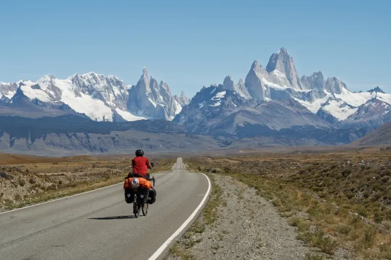
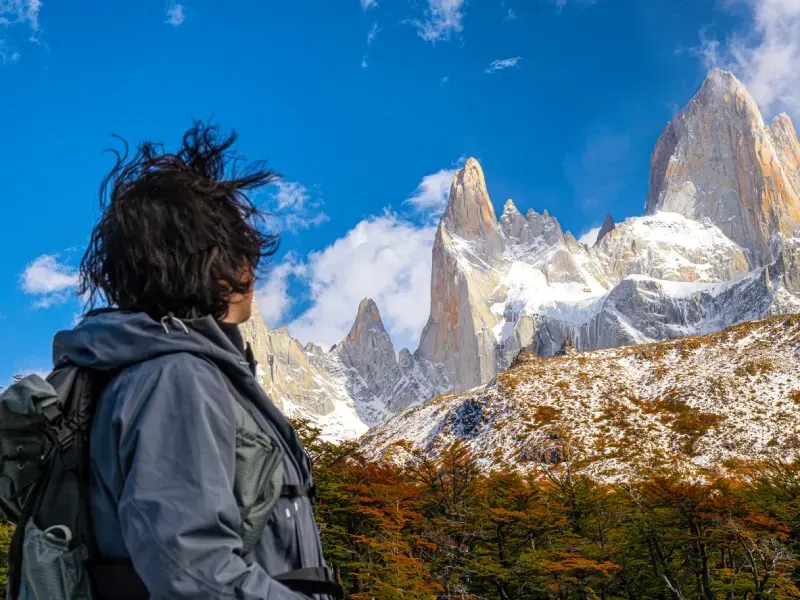
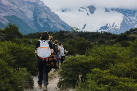
El Chaltén's two signature routes both begin at the edge of town, requiring no additional transport. Laguna de los Tres covers 25 kilometers round trip over 8 to 9 hours, finishing at a high lagoon with Fitz Roy filling the skyline ahead; the final kilometer climbs about 400 meters steeply. Laguna Torre is the more forgiving of the two — 19 kilometers round trip, 7 to 8 hours, rated moderate. Both trails start at the Base Fitz Roy portal, where the national park access fee is checked.
Watch for condors, guanacos, and huemul deer
Wildlife distribution across the park follows the terrain with reliable logic. The open Patagonian steppe spreading around El Calafate sustains guanaco, rhea, and the grey fox; the enclosed Andean-Patagonian forest conceals the endangered huemul deer and the striking Magellanic woodpecker; and the exposed ridgelines and thermal columns above the granite peaks belong to the Andean condor. Puma inhabit the park as well, though sightings are rare enough that an encounter counts as genuine fortune.
![Perito Moreno Glacier walkways tourists]()
When is the best time to visit Los Glaciares National Park?
December through February offers the warmest weather but also the biggest crowds. Spring and autumn are quieter alternatives. Perito Moreno remains accessible year-round; in winter, El Chaltén's trails stay open but are often snowy, and some tours, such as Big Ice, do not run.
How many days should I spend in Los Glaciares National Park?
Allow five to seven days to explore both the glacier-focused southern sector and the hiking trails around El Chaltén without rushing. Three days can cover a few highlights.
How do I get to Los Glaciares National Park?
Fly into El Calafate and take a bus, rental car, or transfer to the southern sector. For northern-sector hikes, travel onward to El Chaltén, where several trails start directly from town.
What are the best things to do in Los Glaciares National Park?
Highlights include viewing Perito Moreno from its walkways, taking a boat trip to Upsala and Spegazzini, and hiking to Laguna de los Tres or Laguna Torre. Guided ice trekking offers a closer glacier experience.
Can I walk on Perito Moreno Glacier without a guide?
No. Walking on the glacier requires an authorized guided tour. Ice treks have age, health, and fitness restrictions, so check your eligibility before booking.
The journey into this corner of Argentine Patagonia begins at Comandante Armando Tola International Airport (FTE), which sits 23 kilometers outside El Calafate — a straightforward 20 to 30 minute drive under ordinary conditions. Daily flights link the town to Buenos Aires, with regular direct services to Ushuaia and Bariloche (more frequent in high season) and only limited regional flights to towns such as Río Gallegos, so most travelers fly in directly from Buenos Aires. At the terminal itself, the options for onward travel are well-stocked: private transfers, shared shuttles, taxis, remises, and rental car counters from Hertz, Avis, and Servicar all operate from the arrivals area. The southern sector of Los Glaciares National Park Argentina lies roughly an hour west of town along Ruta 11, with the official park entrance appearing near Km 49 on the approach to Perito Moreno.
Travel between El Calafate and El Chaltén
El Chaltén, the northern sector's gateway, is served by daily buses from El Calafate all year round — at least two departures a day, with more from October to April — and the ride takes about three hours. Arrival there effectively places you at the trailhead — the park's most celebrated northern routes begin directly on the town's edge, eliminating any need for further transport once you've checked in.
Choose hotels, hostels or approved campsites
Accommodation across both towns spans the full range, from hostel dormitories to well-appointed boutique lodges, and the window where advance booking becomes non-negotiable runs from December through February, with Easter week adding another pressure point. Campers have designated sites in both sectors:
|
Campsite
|
Sector
|
Distance
|
|
Lago Roca
|
Southern
|
30 miles from El Calafate
|
|
Bahía Escondida
|
Southern
|
About 4 miles from Perito Moreno
|
|
Poincenot
|
Northern
|
Just over 6 miles from El Chaltén
|
|
Agostini
|
Northern
|
About 6.5 miles from El Chaltén
|
Lago Roca and Bahía Escondida are serviced campgrounds run under concession and charge a nightly fee, while Poincenot and Agostini are free backcountry sites with basic facilities (the park access fee still applies). Whichever you choose, a gas stove is essential — open fires are prohibited throughout the park.
Compare buses, rental cars and private transfers
For those traveling to the glacier on a budget, the Caltur bus from El Calafate costs approximately USD 18, separate from the park entrance fee (ARS 50,000 per day for foreign visitors since June 2026). Private transfers and guided tour shuttles both cover the route in around 1.5 hours, though the shuttle option includes a bilingual guide. Rental cars offer the same journey time with the added benefit of a flexible schedule. Taxis run the identical route in 1.5 hours and typically cost USD 70 to 100 for a small group — a reasonable figure when the cost is split.
![Route 40 Patagonia road Fitz Roy]()
Customize Your Dream Vacation!
Get in touch with our local experts for an unforgettable journey.
Plan Your Trip
Timing shapes nearly every other decision on this trip — which flights make sense, which trails remain passable, and whether you'll share the walkways with hundreds of other visitors or just a handful. Sorting out the calendar, the costs, and a rough daily structure before booking anything saves considerable frustration later.
Choose the Best Season for Weather and Crowds
December through February holds the warmest conditions, with daytime temperatures averaging 17°C, and the park fills accordingly. Trails reach capacity, accommodation books out weeks in advance, and the glacier boat tours sell out faster than most visitors anticipate. March through May offers a quieter alternative — temperatures drop to around 11°C, but the lenga beech forests turn a deep amber and gold, and the crowds thin to a far more manageable level. Spring, spanning September through November, sits closer to 12°C and draws noticeably fewer visitors than summer, making it a sound choice for anyone who values solitude over peak warmth. Winter is a different matter entirely: El Chaltén's trails stay open but are often snow-covered, days are short, Big Ice does not operate (it runs only from mid-September to April), and many services cut back their schedules, though the Perito Moreno walkways remain open year-round and the glacier looks at its most dramatic beneath low winter cloud.
Check Current Entry Fees and Ticket Rules
Since 1 June 2026, foreign visitors pay 50,000 Argentine pesos per day to enter the park (up from 45,000 in 2025), Argentine nationals pay 25,000 and Santa Cruz residents 8,000, and a second visit within 72 hours is half price. Worth noting separately: since 21 October 2024, the same access fee has also been charged in the El Chaltén sector, at three portals (Base Fitz Roy, Los Cóndores and Río Eléctrico) that cover the area's main trails. Tickets can be bought in advance for a specific date on the national parks' official site (ventaweb.apn.gob.ar) or at the portal booths by card or QR code; buying online beforehand saves queuing at the trailhead.
Budget for Meals, Transport and Guided Tours
The full-day Todo Glaciares boat cruise past Upsala and Spegazzini starts at around USD 196 in the low season and costs more in summer, while shorter outings such as the Nativo Experience — which moves through nearby lakes and caves — start around USD 130. Airport transfers between the airport and town add roughly USD 12 each way. Stack transport, entry fees, and a guided excursion into a single day, and USD 150 to 300 per person is a realistic figure before accommodation enters the calculation.
Build a Three-Day Highlights Trip
Day one belongs entirely to Perito Moreno — the walkway circuits, the calving face, and lunch at the on-site restaurant positioned directly above the ice. Day two calls for the drive north to El Chaltén followed by the afternoon hike to Laguna Capri, a four- to five-hour round trip that keeps Fitz Roy in view for much of its length. Day three wraps up with the Laguna Torre trail before the return journey south.
Allow Five to Seven Days for Both Park Sectors
Three to five days covers the essential highlights: Perito Moreno, a pair of El Chaltén trails, and one boat or ice trekking excursion. Seeing both sectors without feeling rushed, however, calls for five to seven days — enough time to absorb what each half of the park offers rather than simply ticking off landmarks.
Book Key Tours Early and Leave Time for Bad Weather
Hielo y Aventura holds the exclusive concession for guiding walkers onto Perito Moreno's surface, and operators that appear to be competitors eventually route their clients through this same company. Booking directly and early during the summer months eliminates the uncertainty. Accommodation fills at the same pace, so rooms warrant early reservation too. Patagonia's weather operates on its own schedule entirely — wind and rain can shut down an itinerary within hours — so building a buffer day or two into any plan that depends on clear conditions is not overcaution but simple practicality.
![Patagonia autumn lenga forest Fitz Roy]()
The hazards in Los Glaciares National Park Argentina are not abstract. Glacier ice moves, Patagonian weather turns without warning, and mountain terrain demands honest self-assessment. Treating these conditions with the seriousness they deserve is what separates a well-executed expedition from one that ends badly.
Pack layers, rain gear, and trail essentials
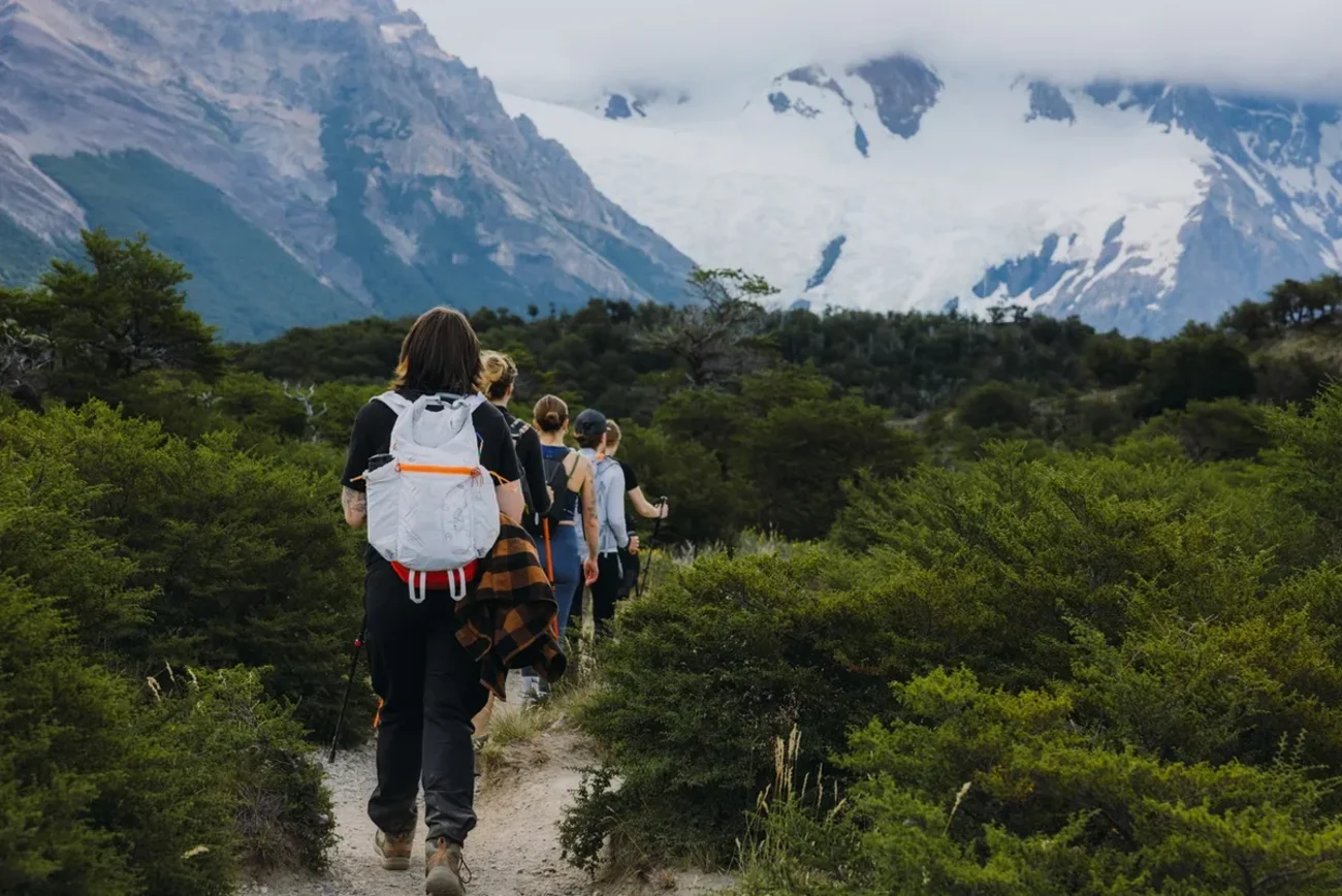
Conditions on these trails can shift from calm to hostile within minutes — bright mornings offer no guarantee of an easy afternoon. Layering is the foundational principle: waterproof outer shells, moisture-wicking mid-layers, and enough thermal insulation to handle sudden temperature drops. Rangers in El Chaltén specifically advise carrying a headlamp on longer routes, since trails have a way of running longer than anticipated, and water is rarely a concern since most streams along the way are safe to drink directly.
Match your route to your fitness and check park alerts
Trail difficulty here is measured in walking hours rather than kilometers, a more honest metric given the terrain. Rangers can advise on which routes become genuinely dangerous under high wind — a frequent Patagonian reality. Glacier trekking adds a further layer of restrictions: the operator does not accept pregnant travelers or people with knee conditions or limb prostheses, and it applies strict age limits — 8 to 65 for Minitrekking, while the Big Ice excursion narrows eligibility further still, accepting only those aged 18 to 50. The approach to Big Ice includes about an hour of walking over steep, unstable moraine — worth verifying conditions before committing to that route.
Respect glacier safety limits and tour restrictions
Perito Moreno's ice face advances roughly two meters every day, and calving events — where building-sized blocks shear away without warning — are precisely why vessels maintain a mandatory distance of 300 to 400 meters from the glacier wall. On Perito Moreno, walking on the ice is permitted only with the sole authorized concessionaire, and independent glacier walking is not allowed anywhere within the park.
Carry out waste, prevent fires and give wildlife space
The park operates on a strict carry-in, carry-out principle — that includes toilet paper, which must leave with you. Open fires are prohibited throughout Los Glaciares; gas stoves are the only permitted cooking method, and domestic animals are not allowed past the entrance. Guanacos, condors, huemul deer and the park's other residents are best observed at a distance — feeding or approaching wildlife disrupts behavioral patterns that have developed across generations in this landscape.
Conclusion
Few wilderness areas on earth ask so little of the imagination. Los Glaciares does the work itself — granite spires that pierce cloud cover, glaciers that groan and fracture at the water's edge, and forests that shelter creatures found almost nowhere else on the continent. The park's two sectors are genuinely distinct experiences, and treating them as such, rather than rushing between them, is what separates a memorable visit from a hurried one.
Secure your Hielo y Aventura booking well before arrival if ice trekking is on the agenda, buy your national park access tickets online before you go, and pack windproof layers regardless of the forecast. Patagonia's weather operates on its own terms, and the most seasoned visitors here are the ones who built spare days into their itinerary rather than fighting that reality.
Above all, the park's rules on waste, fire, and wildlife distance are not bureaucratic formalities — they are what keeps this ice-carved corner of the world as staggering for the traveler arriving a decade from now as it is today.
![hiker windy Patagonia Fitz Roy]()