Table of content
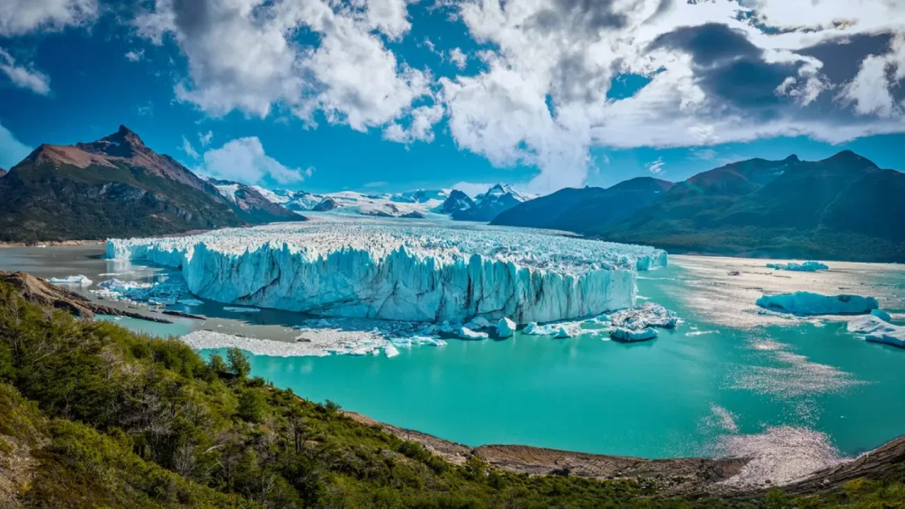
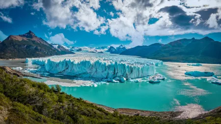
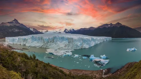
A wall of ice rising as tall as a 20-story building, flanked by mountain ranges and glacial lakes — that is the scene that greets visitors at Perito Moreno. The geography behind it, and the optical physics that give it that distinctive color, are worth understanding before you arrive.
Where it sits in Los Glaciares National Park
Perito Moreno Glacier occupies Santa Cruz Province within Los Glaciares National Park, a protected expanse of about 727,000 hectares (Argentina's largest national park) encompassing Magellanic forest, glacial lakes, and the jagged peaks of the Andes. UNESCO recognized the park as a World Heritage Site in 1981, and the glacier itself lies roughly 78 kilometers from El Calafate, the small Patagonian town that serves as the primary gateway for most visitors.
The glacier's name honors Francisco Moreno, a 19th-century explorer whose surveys of this remote region proved instrumental in resolving the long-contested Andes border dispute between Argentina and Chile in 1902. His namesake glacier descends from the Southern Patagonian Ice Field at an elevation of 2,100 meters, terminating at Lago Argentino, which sits at just 180 meters above sea level. That nearly 2,000-meter drop is no incidental detail — it is the gravitational engine that keeps the ice in constant forward motion toward the lake.
How its length and ice walls compare
Raw figures rarely convey the sensation of standing before an ice mass of this scale, but they establish a useful frame of reference:
|
Measurement
|
Figure
|
|
Length
|
30 km
|
|
Width at the front
|
5 km
|
|
Wall height above water
|
About 74 m on average
|
|
Total ice depth
|
170 m
|
The terminus rises sheer from the surface of Lake Argentino, its face perpetually in flux. Calving events reshape the front daily, which means the profile visible one week can differ entirely from the next. The boardwalk system along the Magallanes Peninsula positions visitors close enough to absorb that scale without requiring a boat crossing or a guided trek onto the ice.
Why the glacier looks blue
Fresh snow is white. Glacial ice, under the right conditions, is unmistakably blue — and the distinction between the two reveals something fundamental about the physics of light and compression.
Newly fallen snow holds air between its flakes, and that trapped air scatters incoming light across the full visible spectrum, producing the bright white appearance familiar to any observer. As successive snowfalls accumulate over years and decades, the weight of the upper layers bears down on those below, expelling the air and compressing the snow crystals into dense, interlocking ice. That density changes how the material interacts with light: the longer wavelengths — red, orange, yellow — are absorbed, while the shorter blue wavelengths scatter back toward the observer.
The effect is most vivid at freshly fractured surfaces. Where a chunk has calved away or a crevasse has split open, the older, denser ice beneath is exposed, and the blue appears at its most intense. From a distance, the white surface crust conceals these inner layers entirely, but at Perito Moreno, where calving is a daily occurrence, those brief glimpses of deep glacial blue are rarely in short supply.
![Perito Moreno Glacier blue ice wall]()
The label "growing glacier" has followed Perito Moreno for decades, and it earned that reputation honestly. But the full picture involves ice physics, lake geometry, and a recent shift in behavior that has drawn serious attention from the scientific community.
How Snowfall Feeds Ice From the Southern Patagonian Ice Field
Perito Moreno draws its mass from the Southern Patagonian Ice Field, a frozen expanse stretching 350 km and covering approximately 12,200 km². Westerly winds arriving from the Pacific carry extraordinary moisture loads, depositing up to 10,000 mm of snow annually across the highest reaches of the ice field. That accumulation, sustained across decades, is what keeps the glacier alive.
The passage from fallen snow to moving glacier ice follows a well-understood sequence:
-
Accumulation: Snow settles at elevation and survives summer without melting, building layer upon layer.
-
Compaction: The weight of successive layers squeezes air from older snow beneath, converting it gradually into dense glacial ice.
-
Flow: Gravity draws the compacted mass downhill through the mountain valleys that channel it toward the lake.
-
Loss: At the lower terminus, ice melts and calves away, shedding mass as icebergs into Lake Argentino.
Perito Moreno is one of 48 glaciers drawing from this same ice field. Through its central section, the ice advances at roughly two meters per day — a relentless, almost imperceptible forward motion that has defined the glacier's character for as long as records exist.
Why Moving Forward Does Not Always Mean Growing
This is where the distinction matters. The glacier advances between June and December, then pulls back between December and April, cycling through seasonal shifts that can mislead casual observation. Watching the front push toward the peninsula does not confirm the glacier is gaining mass overall.
Advance and growth measure different things entirely. A glacier's terminus can creep forward even as the ice loses more volume through melting than it receives through snowfall. What determines actual growth is the mass balance — the relationship between accumulation at the top of the ice field and loss at the calving front. An advancing terminus alone tells only part of the story.
How the Glacier Held Its Ground for Nearly a Century
Few glaciers in Patagonia managed what Perito Moreno sustained across roughly a century of observation. Between 2000 and 2019, its front moved only about 100 meters overall, fluctuating back and forth by roughly 50 meters a year — a near-stationary terminus at a time when neighboring glaciers like Upsala and Viedma were retreating at rates that alarmed researchers. Scientists still debate the precise reasons behind this stability, though a large accumulation zone at high elevation and a subglacial rock ridge beneath the terminus, which acted as an anchor, appear to have played a stabilizing role. That combination kept the ice in something close to equilibrium while the rest of southern Patagonia's glacial landscape contracted steadily around it.
What Recent Retreat Means for That Reputation
The equilibrium did not hold. Researchers trace the turning point to the late 2010s, when snowfall at the top of the glacier stopped compensating for losses, with visible retreat measurable at the front face from 2020. Since 2019, parts of the glacier front have retreated by more than 800 meters. Along the northwestern shore of Canal de los Témpanos, the ice pulled back 800 meters in just four years. Surface lowering rates near the terminus tell an equally stark story: 0.34 meters per year between 2000 and 2019, rising sharply to 5.5 meters per year between 2019 and 2024. Researchers now describe this as the glacier's most significant retreat in a century — a finding that sits uncomfortably alongside the fame Perito Moreno built on the claim of defying a warming world.
![Perito Moreno Glacier aerial view Southern Patagonian Ice Field]()
The sound arrives before the movement does. A low, percussive crack rolls across the water — something between a rifle shot and distant thunder — and then a slab of ice, some 70 meters tall and roughly the size of a 20-story building, drops clean into the lake below. Guides who have spent years working these platforms report that chunks of this scale have become a routine feature of the last four to six years, whereas a couple of decades ago, they were far less frequent. That phenomenon is calving, and it accounts for only part of what makes this glacier so theatrically, almost violently, alive.
How everyday calving differs from a major rupture
Calving requires no special trigger. Stress accumulates inside the ice as the glacier flows — cracks propagate, the lake undermines the base, and unsupported columns of ice eventually yield to gravity. The glacier's terminus spans roughly 5 km and rises between 55 and 80 meters above the water at its calving front, with surface ice pushing through the heavily crevassed edge zone at speeds up to 800 meters a year. The wall is never truly static.
A rupture operates on entirely different mechanics. Rather than individual columns surrendering to gravity, a rupture demands the complete failure of the contact zone between ice and land — a failure driven not by gravity alone, but by the enormous hydraulic pressure of trapped water. Ruptures only occur after the glacier has formed a dam, and though both events end with ice and water colliding spectacularly, the forces producing them share almost nothing in common.
How an ice dam raises the water in Brazo Rico
When the glacier's advancing front presses hard enough against Magallanes Peninsula to close the channel entirely, Brazo Rico loses its connection to the main body of Lake Argentino. Water with nowhere to go begins to rise — recent events have recorded rises ranging from about 1 meter to more than 10 meters, and historically the level in Brazo Rico has climbed as much as 30 meters above the main lake's surface. That pressure differential doesn't hold indefinitely. Water finds the weakest point in the ice wall, seeps through, and carves a tunnel from within. The tunnel widens as the rushing current melts its own passage, until what once sealed two bodies of water apart becomes a solitary arch of ice trembling over a torrent below.
Why the ice bridge collapses on no fixed schedule
The discharge figures alone tell a story of wild variability. A sudden-type rupture event can unleash up to 8,000 cubic meters of water per second; a minor burst might release only 123 cubic meters per second. Between 1966 and 1988, ruptures arrived every two to four years, then fell entirely silent for 16 consecutive years until the next rupture in 2004. That event, watched by an estimated 10,000 people, saw Brazo Rico rise about 10.5 meters above the main lake before the dam gave way, releasing a peak flow of around 5,000 cubic meters per second.
No formula predicts when the next collapse will come. The dam cannot form unless the glacier's front makes physical contact with the peninsula — without that seal, there is no trapped water, no tunnel, no arch, and ultimately no rupture to witness. The glacier decides the schedule entirely on its own terms.
![Perito Moreno Glacier calving ice falling into lake]()
Is Minitrekking worth choosing over the boardwalks or a boat tour?
Minitrekking suits visitors who want to walk directly on the glacier with a guide. The boardwalks offer wide views without an extra tour fee, while boat trips provide a different perspective from lake level.
How much time should I allow for Minitrekking at Perito Moreno?
Expect about 1.5 hours on the ice and roughly ten hours for the full trip, including transport from El Calafate. Keep this timing in mind when planning other activities that day.
Should I book glacier tours in advance?
Yes, especially during the busy December–February season, when places can sell out days ahead. Reserve park entry and boat or trekking tours before your visit.
What should I bring for a visit to Perito Moreno Glacier?
Pack layers, a windproof jacket, and sunglasses for strong glare from the ice. Prepare for rain and carry some Argentine pesos in case card payments are unavailable.
Can I enjoy Perito Moreno Glacier without joining a tour?
Yes. The boardwalks are included in park admission and let you explore the viewpoints independently. Allow two to three hours for a short visit, or three to four hours to cover all the trails at an easy pace.
Customize Your Dream Vacation!
Get in touch with our local experts for an unforgettable journey.
Plan Your Trip
Few glaciers on Earth offer this kind of range. You can experience Perito Moreno from a sheltered wooden boardwalk, from the deck of a boat cutting through iceberg-scattered water, or from the glacier's surface, with crampons biting into ancient blue ice. Each approach reveals something the others cannot, and the choice says as much about the visitor as it does about the glacier.
Boardwalks and viewpoints: See the ice without a tour
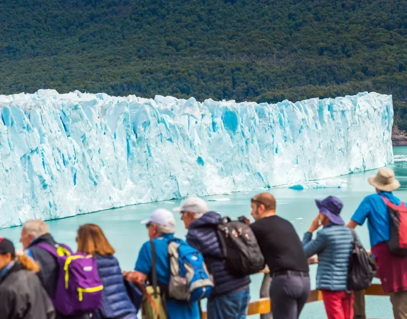
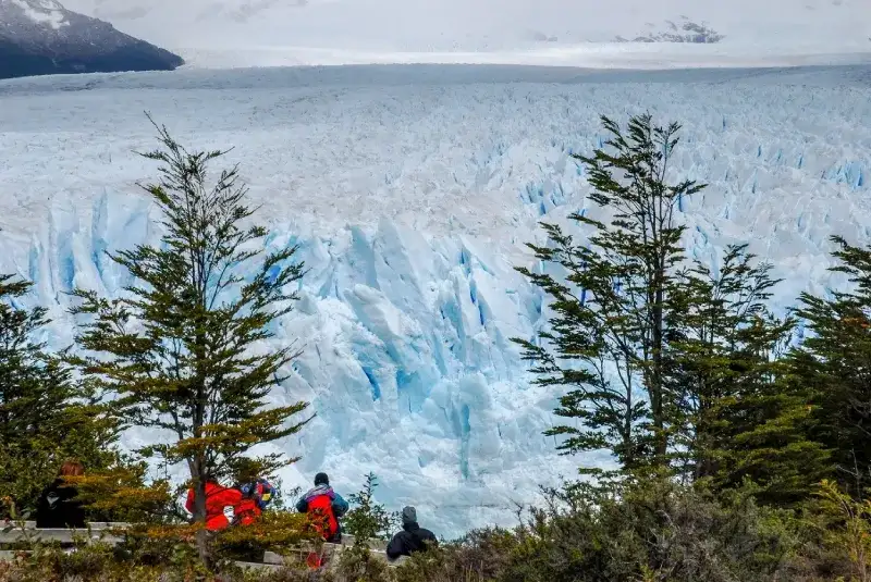
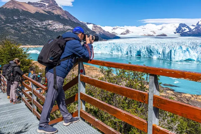
The boardwalk network is where most visits begin, and for good reason — it requires nothing beyond a park ticket and a willingness to walk. Six connected, color-coded trails, including the Central, Lower (Inferior), Coastal, Forest, and Accessible trails, trace roughly 4 kilometers of walkways across the Magallanes Peninsula, each one offering a different angle on the calving front. The Accessible trail is built for wheelchair users and strollers, and a free shuttle bus runs every 10 to 15 minutes between the parking area and the walkway entrance, making the approach effortless. Allow 3 to 4 hours to cover all the trails without rushing, and make use of the restaurant near the entrance for coffee or a hot meal before the return journey.
Boat trips: View the glacier from Lake Argentino
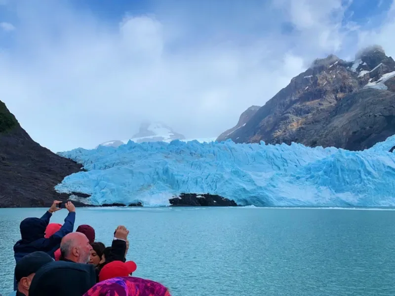
The ice wall reads differently from water level. Standing on a boardwalk, the glacier fills the horizon; from a boat, it towers directly overhead, and the sense of scale becomes something closer to disorienting. Southern Spirit offers departures from USD 50 per person, while Hielo y Aventura starts around USD 55, with both operators running roughly three sailings a day. Each trip lasts about one hour. Those wanting a wider view of the ice field can join full-day cruises from Punta Bandera, which pass the faces of Upsala and Spegazzini glaciers before arriving at Perito Moreno.
Minitrekking and Big Ice: Compare guided ice walks
Setting foot on the glacier itself is a categorically different encounter. The surface cracks and groans underfoot, the blue deepens where crevasses open, and the scale of the ice field only becomes real once you are standing on it. Both tours begin with a boat crossing and a short hike before crampons are strapped on, and both traditionally end with a whisky served over glacier ice.
|
Tour
|
Time on ice
|
Age range
|
Starting price
|
|
Minitrekking
|
1.5 hours
|
8–65
|
USD 330
|
|
Big Ice
|
3 hours
|
18–50
|
USD 459
|
A third option, Minitrekking 2, covers 5 kilometers of ice and suits visitors between 18 and 55. Big Ice demands more from its participants — roughly an hour of moraine hiking before the ice is even reached — but rewards that effort with a plateau crossing and lunch served on the glacier itself.
Guided kayaking: Explore from the water at a safe distance
Paddling among icebergs offers an intimacy that neither boardwalks nor boats quite match. The water is close, the ice is close, and the silence between calving events is striking. Kayaking tours run about 1.5 hours on the water, with full-day packages stretching to 9 hours and half-day versions running 3.5 hours. Gore-Tex drysuits, thermal layers, and life jackets are all provided, and no prior paddling experience is required. Participants must be at least 14 years old, and certain operators take groups along the glacier's north face through the Iceberg Channel, one of the quieter and more visually striking routes available.
![Perito Moreno Glacier tourists boardwalk viewpoint]()
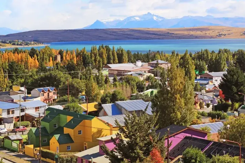
El Calafate sits 78 kilometers from the glacier — close enough for a day trip, far enough that the choices you make around season, transport, and timing shape the experience considerably.
Best time to visit: Weather, daylight, and crowds
October through April brings the most reliable conditions, with full tour schedules running across all activity types. The peak months of December through February see the warmest temperatures, hovering around 17–18°C, but the platforms fill quickly and boat slots disappear days before departure. March to May and September to November offer a quieter alternative — cooler air, thinner crowds, and trails that feel far less hurried. Arriving before 9 am matters: the boardwalks sit calm at that hour, and the first buses begin filling the viewpoints by 10 am.
Getting there by bus, rental car or guided transfer
Route 11 connects El Calafate to the glacier over roughly 80 kilometers, a journey of about 1.5 hours each way. Public buses run between USD 25 and 35. Renting a car, including fuel and park entry, typically lands between USD 60 and 100, while private transfers range from USD 100 to 150 for a round trip. Guided tours that include transport vary considerably — from USD 50 for a basic transfer up to USD 500 for packages with trekking and boat access layered in.
Checking current park fees, hours and booking rules
From September through April, entry to the glacier area runs from 8 am to 6 pm, and visitors can stay until 8 pm. From May through August, entry runs from 9 am to 4 pm, with visitors allowed to stay until 6 pm. Summer tour slots — particularly for Minitrekking and boat departures — sell out days in advance, so booking park entry and activity permits before arrival is not optional during peak season; it is simply the practical approach.
How much time to allow for your chosen activities
The gap between a short walkway visit and a full trekking day is significant. A self-guided circuit across the boardwalks takes two to three hours; adding a boat cruise extends that to a half-day of four to five hours. Full days combining trekking and water access require six hours or more. Minitrekking runs approximately ten hours door to door from El Calafate, while Big Ice stretches to around eleven or twelve hours once transfer time factors in.
What to pack for wind, rain and strong glare
Patagonian weather does not negotiate. Temperatures drop without warning, wind comes off the ice field with force, and the glare from the glacier surface is sharp enough to cause real discomfort without proper eye protection. Layers and a windproof outer shell are non-negotiable. Carry Argentine pesos as a backup — card readers at the park entrance and the food stalls near the walkways are known to fail.
Checking access needs, tour limits and park safety rules
Visitors with reduced mobility will find the Accessible trail the most practical option, with a dedicated upper car park for visitors with reduced mobility right next to it. Drones are prohibited within park boundaries without special authorization, and staff hold the authority to close walkway sections when wind speeds become unsafe — a precaution worth noting if conditions look unsettled on arrival.
Conclusion
Few glaciers demand attention the way Perito Moreno does. Its century-long stability set it apart from nearly every other ice mass on the planet. Its recent retreat, measured in surface lowering rates that jumped from 0.34 meters a year (2000–2019) to 5.5 meters a year (2019–2024), is quietly altering that reputation. Science rarely offers drama on this scale, yet here, the data and the spectacle arrive together: blue ice walls rising some 20 stories above the lake, rupture events that discharge thousands of cubic meters of water per second, and a calving front that reshapes itself daily.
What the boardwalks, the boat crossings, and the crampon treks share is proximity to something genuinely rare — a glacier still legible enough to study, still spectacular enough to stop conversation mid-sentence. The season you choose and the activity you book will shape the experience, but the glacier itself does most of the work. Perito Moreno has earned its standing not through reputation alone, but through the kind of raw, measurable, visible behavior that keeps drawing scientists and travelers back to the same frozen shore on Lake Argentino.
![El Calafate town Lago Argentino Patagonia]()