Table of content
The citadel’s placement explains much about why it survived unnoticed for so long. Machu Picchu occupies a precise geographic threshold — the meeting point of the Peruvian Andes and the Amazon Basin, on the eastern slopes of the range, with the upper Amazon stretching out below and sustaining a remarkable breadth of plant and animal life. The Historic Sanctuary enclosing the ruins spans 32,592 hectares of mountain slopes, peaks, and valleys, a protected territory Peru formally established at 325.92 square kilometers back in 1981. More specifically, the site occupies the Eastern Cordillera of southern Peru, roughly 80 kilometers northwest of Cusco, above the Sacred Valley and alongside the Urubamba River. That river coils around the ridge on three sides, and the cliffs along its banks fall a sheer 450 meters straight down to the water below. The site rests at 13.111 degrees south of the equator, firmly within the Southern Hemisphere, where morning mist off the river is less a curiosity than a daily certainty.
How High Machu Picchu Sits Compared With Cusco
The citadel itself sits at 2,430 meters — 7,970 feet — above sea level. Cusco stands considerably higher at 3,400 meters, or 11,152 feet, a difference of more than 950 meters between the two. That descent matters more than it might appear on a map. Cusco’s high-altitude air gives way near the ruins to a milder, subtropical highland climate, where annual rainfall averages 2,010 millimeters and humidity holds between 80 and 90 percent. Travelers who descend from Cusco expecting relief from altitude often find that the stone stairways and uneven paths present their own distinct physical demands.
Machu Picchu, Huayna Picchu, and the Citadel: What Is the Difference?
Three distinct things share variations of the same name here — the stone citadel itself and the two mountains flanking it on either side. The table below separates them clearly:
|
Location
|
Elevation
|
|
Machu Picchu citadel
|
2,430 m (7,970 ft)
|
|
Cusco
|
3,400 m (11,152 ft)
|
|
Huayna Picchu mountain
|
2,693 m (8,835 ft)
|
|
Machu Picchu mountain
|
3,082 m (10,111 ft)
|
The names themselves carry meaning worth noting. Quechua gives “machu” as old and “picchu” as peak or summit, making Machu Picchu simply “old peak”. Huayna Picchu holds the reverse — “young peak” — and names the sharp, dramatic mountain that appears in nearly every widely circulated photograph of the site.
Scholarship adds yet another layer of complexity to these names. A 2021 study published in Ñawpa Pacha: Journal of the Institute of Andean Studies argues that the Incas themselves most likely called the entire settlement Huayna Picchu, or simply Picchu, and that “Machu Picchu” only became attached to the ruins following Hiram Bingham’s 1911 publications. Bingham, according to his own field notes, appears to have taken the name from his local guide, Melchor Arteaga.
The mountains themselves are worth distinguishing on their own terms. Huayna Picchu rises to the north of the citadel, its trail gaining approximately 290 meters. Machu Picchu mountain, standing taller and further south, demands nearly twice the effort — 621 meters of elevation gain across roughly 1,600 steps — rewarding those who reach its flat summit with expansive views across the entire valley. The name may sound similar, but the experience of standing on each one is altogether different.
![Ancient Machu Picchu stone structures. Scenic view of mountains with lush greenery.]()
The “Lost City of the Incas” is one of archaeology’s most enduring labels — and one of its least accurate. Local Quechua communities never lost track of the ruins. The more accurate story, as the evidence shows, is one of deliberate obscurity, colonial disruption, and a 1911 expedition that introduced a stone city to the world without fully understanding what it had found.
When the Inca built Machu Picchu
For decades, historians dated construction to between 1438 and 1450, drawing primarily from Spanish colonial accounts of Pachacuti’s ascent to power. That consensus shifted considerably in 2021, when Yale archaeologist Richard Burger led a radiocarbon dating study on 26 individuals interred at the site, applying accelerator mass spectrometry to bone and teeth samples collected from four separate cemeteries. The results were striking — occupation at Machu Picchu extended from roughly 1420 to 1530, pushing the established timeline back by at least two decades and suggesting the citadel functioned as a living settlement for approximately 110 years, not the 80-odd years earlier scholarship had assumed.
Why scholars link the site to the ruler Pachacuti
The revised dates have not unsettled the central argument about who built it. Research from John Rowe, Richard Burger, and Lucy Salazar-Burger consistently identifies Machu Picchu as a retreat created by and for Pachacuti — a royal sanctuary rather than a military stronghold. Burger has proposed that the elite used it as a remove from Cusco’s ceremonial demands. Most archaeologists now classify it as a llaqta, the Quechua designation for a royal settlement bound to a specific ruler, where Pachacuti and his court gathered for rest, ritual, and the administration of surrounding territories. The craftsmanship visible in the Temple of the Sun and the Sacred Plaza makes the point plainly — that quality of stonework was reserved exclusively for those of the highest rank.
What remains unknown about its abandonment
There is no evidence of violence at the site. No signs of sudden attack, no indication of catastrophic collapse. The abandonment, scholars generally agree, unfolded gradually rather than all at once — most likely between 1530 and 1550, as the Spanish invasion dismantled the empire and Pachacuti’s panaca, his royal lineage, lost both the authority and the resources required to maintain the estate. Cloud forest vegetation reclaimed the terraces within decades of that withdrawal. Other explanations persist alongside this one: smallpox, which spread well ahead of the Spanish forces themselves, may have thinned the population who sustained the site, and some researchers note that ordinary Inca citizens may never have known the route to the citadel at all, keeping its existence confined to a small circle of the court.
Local knowledge and Melchor Arteaga’s role in Bingham’s 1911 visit
Hiram Bingham is credited with introducing Machu Picchu to international audiences in 1911, but the account of that day is more layered than the standard telling suggests. It was Melchor Arteaga, a local farmer and innkeeper, who led Bingham and his party across a log bridge and up the mountain slope after Bingham enquired about ruins in the region. At the summit, two Quechua farmers — Richarte and Alvarez — were already cultivating the ancient terraces as vegetable gardens, and it was Richarte’s 11-year-old son who guided Bingham through the final stretch. A Peruvian explorer, Agustín Lizárraga, had reached the site nine years earlier in 1902 and left his mark quite literally — his name carved into the stone of the Temple of the Three Windows, a detail Bingham recorded in his own field journal before quietly setting it aside.
Why Machu Picchu is not the lost city of Vilcabamba
Bingham left that expedition convinced he had located Vilcabamba, the mountain stronghold where the last independent Inca rulers held out against Spanish conquest for nearly four decades. The identification did not survive scrutiny. Explorer Gene Savoy demonstrated in 1964 that Espíritu Pampa, located well to the west of Machu Picchu, was the true Vilcabamba — a finding the broader historical community has since accepted without serious challenge. The irony is considerable: Bingham had walked through Espíritu Pampa himself during that same 1911 expedition and dismissed it, having found only a scattering of stone walls and collapsed bridges.
![Woman exploring Machu Picchu during trip to Peru]()
What are five fascinating facts about Machu Picchu?
Machu Picchu sits 2,430 meters above sea level, its name means “old peak,” and its finest stone walls use no mortar. It also has 16 fountains and became a UNESCO World Heritage Site in 1983.
Was Machu Picchu really a lost city?
Not to local people, who knew about the ruins before Hiram Bingham arrived in 1911. His visit brought international attention to the site, but he mistakenly identified it as the lost Inca city of Vilcabamba.
What hidden engineering features helped Machu Picchu survive?
Much of its engineering lies underground. Layered terraces, foundations, and drainage systems managed heavy rainfall, reduced erosion, and helped stabilize the steep slopes.
How did Inca builders fit Machu Picchu’s stones so precisely?
Builders shaped stones with hammerstones, then refined them by eye or with abrasive sand. This careful work allowed blocks to fit tightly together without mortar.
Why is Machu Picchu linked to the Inca ruler Pachacuti?
Researchers generally regard Machu Picchu as Pachacuti’s royal estate. Its fine stonework and ceremonial buildings suggest it served his court as a place for rest, religious ceremonies, and governing nearby lands.
A ridge suspended between two peaks offers no flat ground, no easy approach, and no margin for structural error. The Inca accepted those conditions entirely and built around them, working with the mountain’s granite, gravity, and rainfall rather than attempting to overcome any of it.
How builders shaped and fitted stone without mortar
The mountain itself provided an unexpected advantage. Machu Picchu rests on a 250-million-year-old granite intrusion with a natural rectangular joint pattern; Inca workmen identified this fracture system and exploited it deliberately when quarrying blocks. Each stone was then shaped with hammerstones and refined by eye or with abrasive sand until the surfaces met without any binding material whatsoever. The technique, known variously as ashlar or polygonal masonry, produced interlocking joints so exact that the walls still resist a knife blade centuries later.
The human effort behind this was staggering. One Spanish chronicler recorded 4,000 men quarrying and cutting stone at a single site while another 6,000 hauled blocks into position. That labor flowed through mit’a, an Inca tribute system obligating men between 15 and 50 to contribute work on state projects; separate accounts note Pachacuti mobilized 20,000 workers for Sacsayhuamán and 50,000 for the reconstruction of Cusco.
Why terraces did more than grow crops
The 4.9 hectares of agricultural terraces cascading below the citadel were never purely about food. Each terrace was built in carefully sequenced layers: stone chips at the base, followed by gravel, then sand, then topsoil, a composition that ensured sharp drainage while retaining enough moisture through drier months. Notably, researchers found no irrigation turnouts along the canal system; rainfall alone provided everything the terraces needed. The stone retaining walls served a structural purpose as well, holding the hillside against erosion and the constant threat of landslides that any mountain of this gradient presents.
How drains and fountains managed mountain water
What most visitors never see accounts for the majority of Inca effort here. Roughly 60 percent of all construction work at Machu Picchu was buried underground. A spring collection system anchored by a 14.6-meter stone wall fed a 749-meter canal pitched at a 3 percent gradient, carrying water down to the urban sector with controlled, steady flow. That supply fed 16 fountains in sequence, the first of which was reserved for the emperor alone. Around 129 drainage outlets were set into retaining walls across the site, with a central main drain marking the boundary between the urban and agricultural zones.
How Inca roads linked the site to a wider empire
Machu Picchu was never an isolated outpost. The citadel fed into the Qhapaq Ñan, the great Inca road system extending more than 30,000 kilometers across the Andes. These routes climbed above 6,000 meters, binding snowfields, rainforest, and Pacific coastline into a single administrative network that, at the empire’s peak, sustained trade across nearly 4,200 kilometers of territory. The stonework of the citadel and the roads connecting it to Cusco belonged to the same ambition: a civilization that treated the most forbidding terrain in the Americas as infrastructure waiting to be built.
![]()
Customize Your Dream Vacation!
Get in touch with our local experts for an unforgettable journey.
Plan Your Trip
The farming terraces and underground drains speak to Inca pragmatism. The temples speak to something else entirely. Past the agricultural sector, the citadel’s religious architecture reveals how completely the Inca folded cosmology into stone — aligning walls, windows, and carved rock with celestial events that governed the ritual calendar.
The Temple of the Sun and its links to the solstice
The Observatory, more widely known as the Temple of the Sun, rests on a massive granite boulder near the Sacred Plaza, its curved upper wall oriented with a precision that still draws astronomers today. Carefully placed windows in that wall allowed priests to track the June solstice sunrise alongside the first morning appearance of the Pleiades constellation — two events that held deep agricultural and ceremonial significance across the Andean world. Beneath the main structure, a cave carries stone additions widely interpreted as a representation of the underworld in Inca cosmology. At the center, an altar stone carved directly from the same granite as the temple floor is believed to have served ceremonies honoring Inti, the sun god. The structure above and the cave below, the celestial and the subterranean, occupied the same physical space — a deliberate layering of worlds that defined how the Inca understood the sacred.
The Intihuatana stone: What researchers know and still debate
Higher up, at the summit of the upper sector, sits one of the citadel’s most discussed features. The Intihuatana — Quechua for “where the sun is tied” — was carved directly into bedrock and raised on a stepped platform roughly 1.15 meters high. Its shadow behavior follows a clear astronomical pattern: longest toward the south on June 21, shorter and shifted north by December 21. Whether the Inca themselves used the name “Intihuatana” for this stone remains uncertain, and several researchers caution against reducing it to a solar calendar, given its irregular form and the ritual weight it appears to have carried. It was, most likely, something more layered than a timekeeping device — though exactly what remains open.
How sacred mountains shaped the site’s design
The citadel’s placement was never purely practical. The Inca selected this particular ridge partly for its sightlines to apus — mountain peaks venerated as ancestral deities throughout the Andes. Huayna Picchu, Putucusi, and Salkantay surround the site on multiple sides, enclosing it within a ring of peaks that the Inca read not as landscape but as presence. The Observatory’s position directly beside the royal residence reinforced Pachacuti’s standing as a descendant of Inti himself — a claim that required the right geography, the right alignment, and the right stone to hold.
![Group of tourists with a tour guide at Historic Sanctuary of Machu Picchu]()
The citadel and the forest surrounding it are inseparable. What UNESCO recognized in 1983 wasn’t simply a collection of stone buildings — it was an entire living system, one where ancient architecture and extraordinary biodiversity occupy the same mountain slopes, drawing on the same rivers and cloud cover that the Inca themselves once relied upon.
Why UNESCO recognized both its cultural and natural value in 1983
The Historic Sanctuary of Machu Picchu earned its UNESCO inscription as a mixed World Heritage property in 1983, covering 32,592 hectares of mountain slopes, peaks, and valleys. That dual designation was deliberate. The listing acknowledged, with equal weight, both the architectural brilliance of the citadel and the ecological richness that surrounds it. Twenty-four years later, the site secured another distinction — a place among the New Seven Wonders of the World in 2007, a recognition voted on by millions and reflecting just how firmly Machu Picchu holds its grip on the global imagination.
The cloud forest wildlife beyond the stone walls
The numbers alone tell a remarkable story. Within the sanctuary boundaries, researchers have documented 384 tree species, 468 orchids, 279 ferns, 84 mammal species, 443 bird species, 17 amphibians, and 22 reptiles. Spectacled bears move through these cloud forests, as does the Andean cock-of-the-rock, Peru’s national bird, its flame-orange plumage cutting sharply against the green canopy. Perhaps most striking of all: a species of arboreal chinchilla, known only from skulls Hiram Bingham unearthed in 1912 and presumed extinct since Inca times, turned up alive near the citadel in 2009, spotted by a park ranger, with the find formally confirmed by researchers in 2012. A creature the Inca once knew, gone from scientific record for centuries, found living in the same forest that sheltered their royal estate.
How tourism supports local jobs but puts pressure on the site
The same fame that safeguards Machu Picchu’s funding also strains its fabric. UNESCO has long flagged tourism as a double-edged concern: rising visitor numbers, unchecked urban expansion in Aguas Calientes, and increased traffic tied to new infrastructure all compound the pressure on a sanctuary already balancing ecological sensitivity with cultural preservation. The regional economy depends on that footfall, which makes the tension genuinely difficult to resolve.
How entry circuits and visitor rules help protect its future
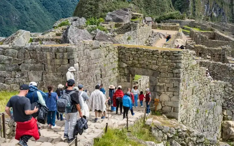
Peru’s response has been structured access. Every visitor must now follow one of four official circuits through the citadel, a measure that distributes foot traffic rather than allowing crowds to pool at the most photographed points. Machu Picchu mountain accepts 400 visitors daily, split across two timed shifts; Huayna Picchu permits 200, spread across four. Large backpacks, drones, tripods, and any physical contact with the structures are prohibited outright. Whether these measures prove sufficient as global interest in the site continues to grow remains an open question — one that conservationists, archaeologists, and Peruvian authorities are still working through.
Conclusion
What Machu Picchu reveals, once the myths are set aside, is something far more compelling than a lost city — a royal estate conceived with extraordinary intelligence, built by thousands of skilled hands, and shaped by a worldview that treated mountains as deities and water as something worth engineering around rather than simply diverting. Pachacuti’s court built it, used it for roughly 110 years, and left it to the cloud forest when the empire could no longer sustain it.
The stonework, the terraces, the fountains, the solar alignments — none of these were accidents of geography or instinct. Each element reflected deliberate choices made by people who understood their landscape with a precision that modern observers are still working to fully appreciate.
Preservation here carries an unusually broad obligation. The sanctuary protects not only carved granite and ceremonial plazas but 443 bird species, 468 orchids, an arboreal chinchilla once thought lost to history, and an ancient road network that once held an empire together. Visitor circuits, entry limits, and strict site rules are not bureaucratic inconveniences — they are what stands between this place and irreversible loss. Machu Picchu has endured five centuries. Whether it endures the next five depends largely on the choices made now.
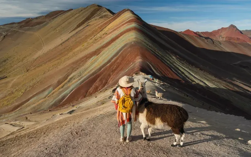
![Woman with alpacas on the background of Rainbow mountain in Peru]()
.jpg "Machu Picchu Facts: The Surprising Truth About Peru’s Lost City")